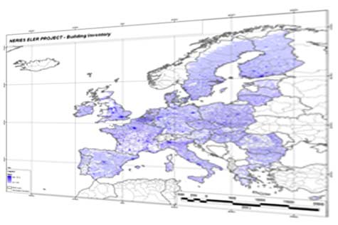
Development of European Building Inventory

Project: Development of European Building Inventory
Project Duration: 2008 – 2009
Project Scale: 30 arc-second (approximately 1 km x 1 km) analysis grid
Project Extent: Europe (CORINE Land Cover Project Boundary)
Project Participants: GRM, Bogazici University Kandilli Observatory and Earthquake Research Institute
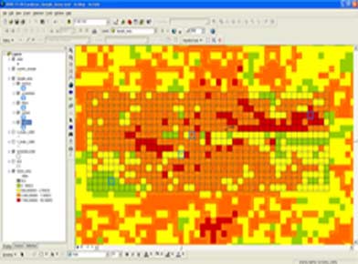
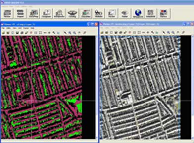
Scope of Project: For European countries participating in the inventory, estimated distribution of building types was determined using image processing applications and statistical calibration analysis. Analysis was performed using satellite imagery, CORINE Land Cover, and Landscan population data. The resulting estimated building distribution was used by Kandilli Observatory’s PAGER project to assign building types and applications to each cell according to the European building classification using distribution ratios of each country’s building types.