Natural Disaster and Risk Management System (NDRMS)

Project: Natural Disaster and Risk Management System (NRMS)
Project Duration: 2013 – 2015
Project Extend: Istanbul
Project Participants: Turkish Natural Disaster Insurance Pool (DASK), GRM
Project Scope:
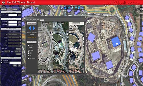
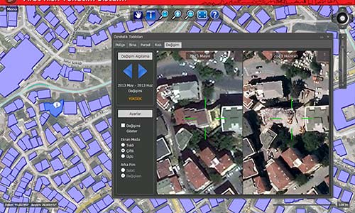
- Development of a system to perform pre-damage calculation based on change detection methodology using satellite images acquired before and during an earthquake as well as photographs taken from the ground.
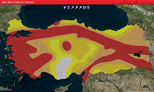
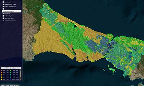
- Earthquake hazard maps generated with probabilistic methods and associated loss estimation analysis results for Istanbul are utilized.
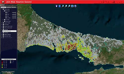
- Location-based DASK insurance policy information, real-time earthquake hazard maps (Boğaziçi University, Kandilli Observatory and Earthquake Research Institute (BOUN-KOERI)), and loss estimation analysis results are integrated and evaluated.
- Financial loss estimation is calculated using a methodology that correlates earthquake hazard analysis and insurance policy location supported by information obtained from multiple sources.
- A web-based GIS risk management system performs spatial analyses using all data discussed above.