3D Topographic Data Production

Project: 3D Topographic Data Production
Project Duration: 2007 – 2008
Project Scale: 1/1000 – 1/5000
Project Extent: Administrative Boundary of Istanbul Metropolitan Municipality
Project Participants: IMM – Directorate of Earthquake and Ground Analysis, OIC (Oyo International Corporation), GRM, SUR – Suuri Keikaku
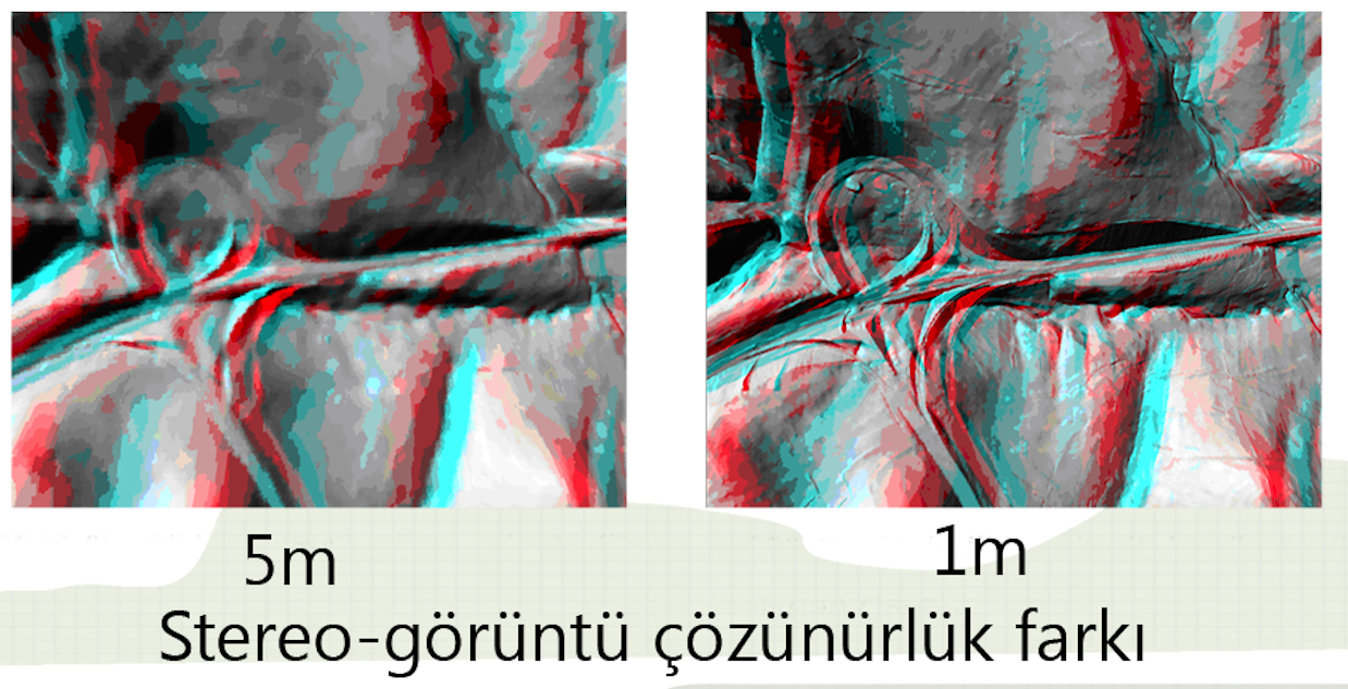
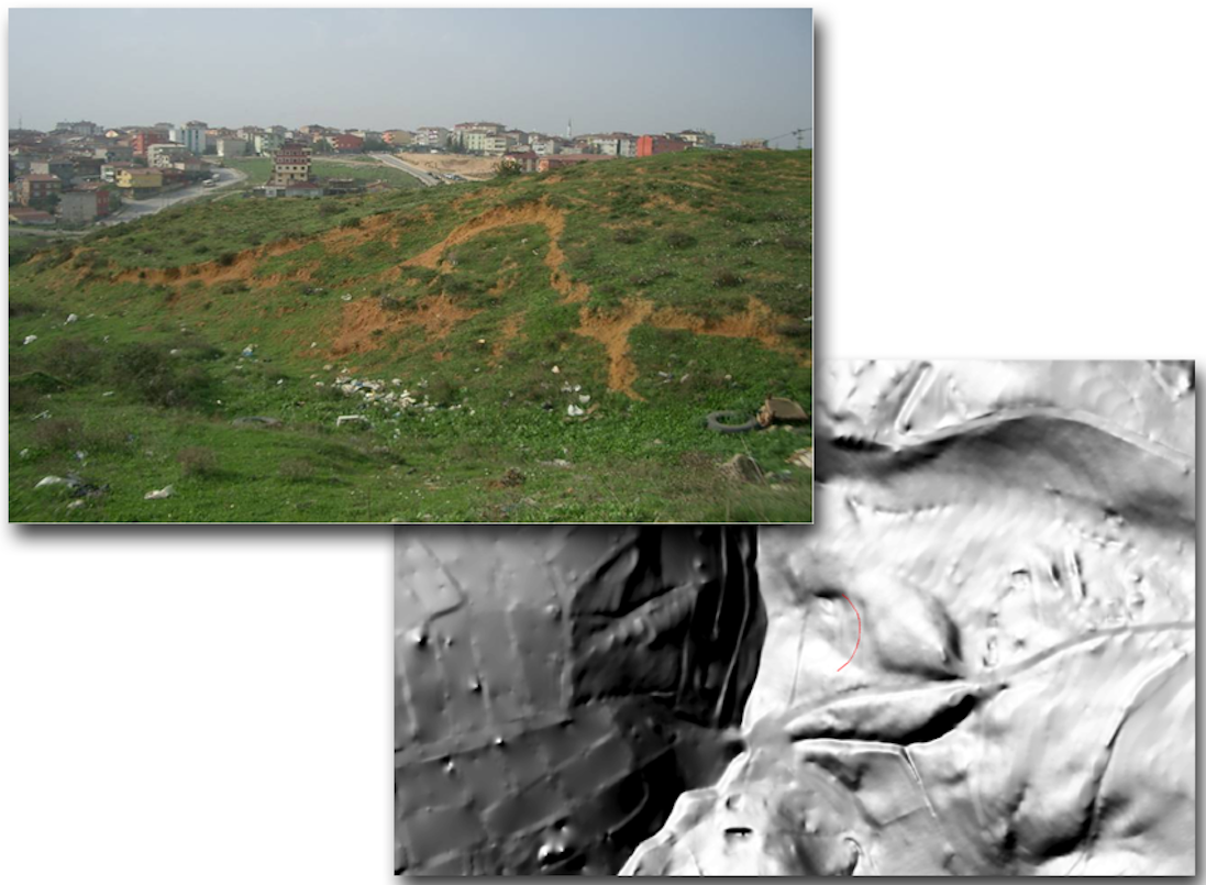
Scope of Project: The production of three-dimensional slope, hypothetical illumination (hillshade), and stereo image maps and data sets for topographical analysis was aimed at soil risk evaluation. Data were produced from geographic sources (existing orthorectified aerial photographs and satellite images of various production dates and scales) and datasets containing attributes on both the horizontal and vertical dimensions.